COIN - Earth to God (Official Video)

BlogBarley
20240131
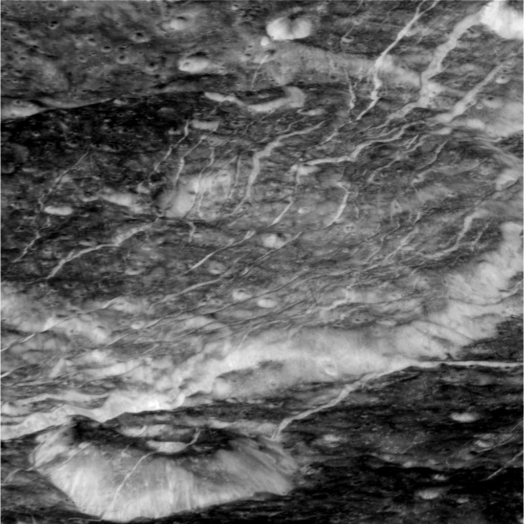
Sol 4078: Mast Camera (Mastcam) stitch

Sol 4078: Mast Camera (Mastcam) stitch
Images taken by MAST_RIGHT onboard NASA's Mars rover Curiosity on Sol 4078 (2024-01-26T08:18:40.000Z) to (2024-01-26T08:27:40.000Z)
Image Credit: NASA/JPL-Caltech/MSSS
Assembled by Barley Culiner with Microsoft ICE
Additional editing with GIMP
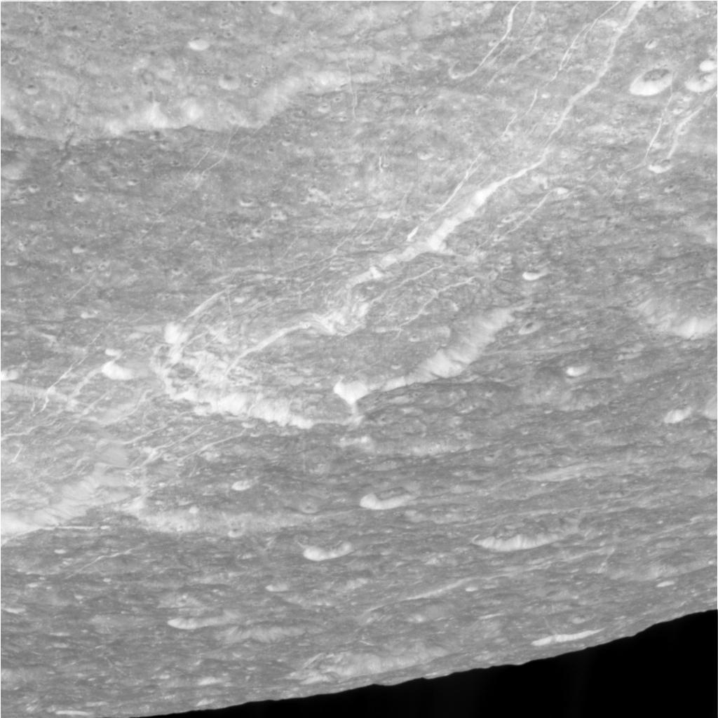
Sol 4080: Mast Camera (Mastcam) stitch

Sol 4080: Mast Camera (Mastcam) stitch
Images taken by MAST_RIGHT onboard NASA's Mars rover Curiosity on Sol 4080 (2024-01-28T09:18:51.000Z) to (2024-01-28T09:27:54.000Z)
Image Credit: NASA/JPL-Caltech/MSSS
Assembled by Barley Culiner with Microsoft ICE
Additional editing with GIMP
20240128
APPROACH MOVIE PROCESS LEVEL 2

100 milliseconds per frame

50 milliseconds per frame
2016-06-12 00:10 UT
NASA / SwRI / MSSS
Mission Phase : MOVIES
All images were cropped and enhanced to 1280 x 720 resolution (width x height) and rotated to a North-up orientation. Contrast-enhancement was applied for moon visibility, along with noise removal and correct color registration. No partial images or images with a TDI of 1 were processed.
Assembled by Barley Culiner with GIMP
Images animated/joined/stitched not edited or manipulated (not photoshopped) All images are free to use but credit must be given, especially to NASA and ESA
20240127
Dione Cassini Raw Image gif


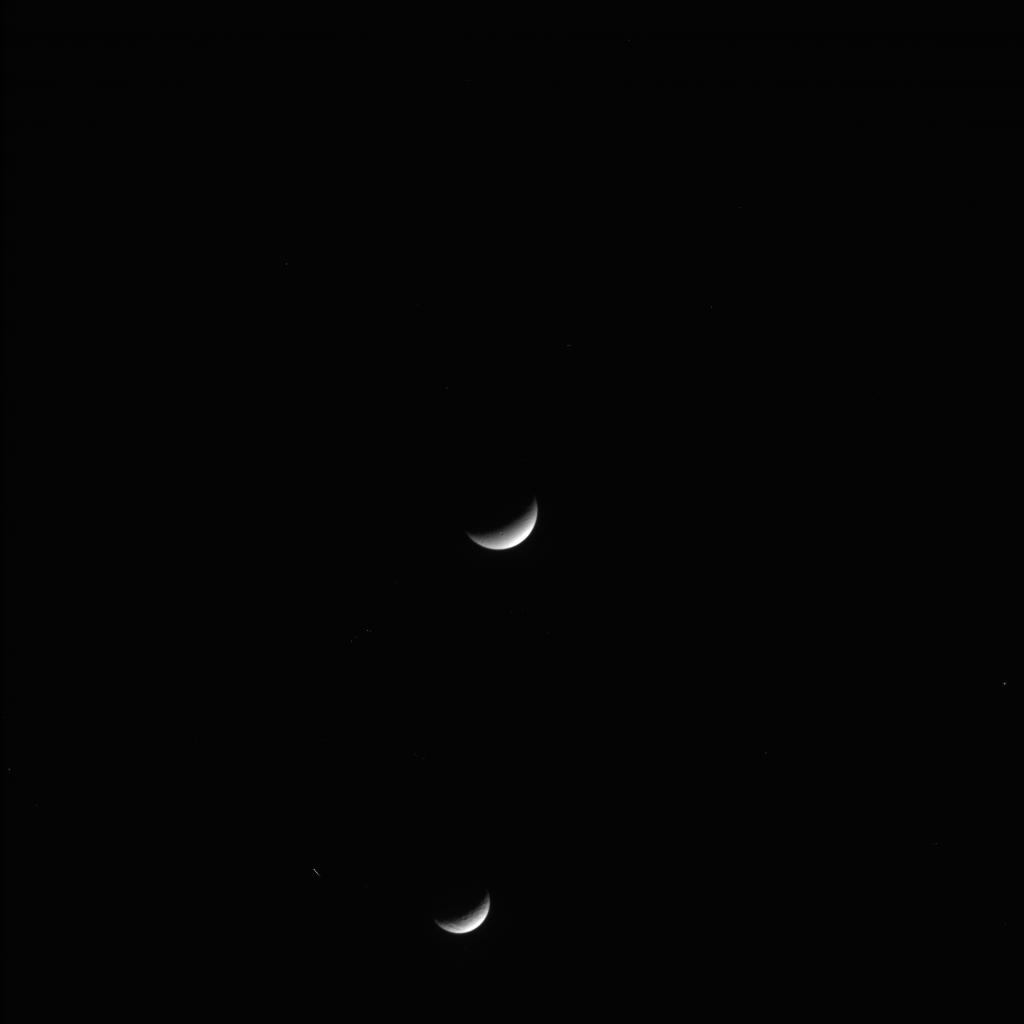


Dione
Cassini Raw Image gif
Image Credit: NASA/JPL-Caltech/Space Science Institute
https://science.nasa.gov/mission/cassini/
Image Credit: NASA/JPL-Caltech/Space Science Institute
Assembled by Barley Culiner with GIMP
Images animated/joined/stitched not edited or manipulated (not photoshopped) All images are free to use but credit must be given, especially to NASA and ESA
Subscribe to:
Posts (Atom)